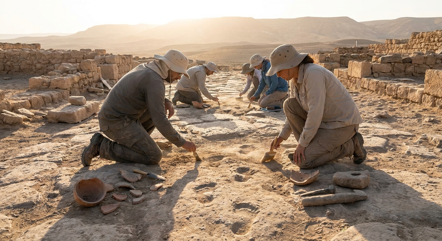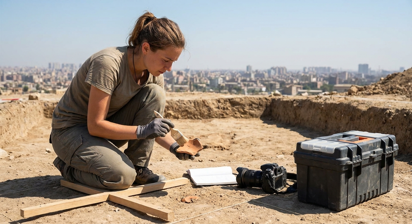
To an untrained eye, an excavation trench can look like a neat hole in the ground populated by people with trowels. To an archaeologist, each change in soil color, each fleck of charcoal, each misplaced nail is a data point in a long-running experiment about human behavior.
Archaeology as a Science of Traces
This list unpacks seven core techniques that transform soil into stories, weaving in specific examples and primary sources to show how method shapes what we can know about the past.
1. Stratigraphy: Reading the Earth Like a History Book
Stratigraphy is the principle that deeper layers are generally older than those above—a concept formalized in geology but borrowed enthusiastically by archaeology. Sir Mortimer Wheeler, who helped systematize excavation methods in the early 20th century, wrote:
> "The archaeologist is digging not things, but people, and not people, but the strata in which their lives are found."
> — Wheeler, Archaeology from the Earth (1954)
Case Study: The Tells of the Near East
At sites like Tell Brak in Syria or Çatalhöyük in Turkey, millennia of occupation created artificial hills. Each occupation level—defined by floors, hearths, and trash pits—represents a phase of life and abandonment.
By carefully peeling back layers, archaeologists can sequence:
- Architectural styles over time.
- Changes in diet via animal bones and charred seeds.
- Gradual shifts in ritual practice.
Stratigraphy underpins dating, but also conflict resolution: when two objects appear together in a sealed layer, they are roughly contemporary, no matter what older typologies claim.
2. Radiocarbon Dating: Counting the Half-Lives of History
Radiocarbon (C-14) dating measures the decay of radioactive carbon in once-living materials. Introduced by Willard Libby in the late 1940s, it revolutionized prehistoric chronology and earned a Nobel Prize.
How It Works
- Living organisms constantly exchange carbon with the environment.
- Upon death, intake stops, and C-14 decays at a known rate (half-life ~5,730 years).
- Measuring remaining C-14 in charcoal, bone, or seeds gives a date range.
Case Study: Dating the Neolithic in Europe
Before radiocarbon, the spread of farming into Europe was inferred from pottery styles. Radiocarbon dates from charred grains at early farming sites—like Linearbandkeramik (LBK) settlements along the Danube—showed surprisingly rapid expansion between c. 5500–4900 BCE.[^1]
Subsequent Bayesian modeling of hundreds of radiocarbon dates has refined that picture into a dynamic, regionally varied process, revealing frontiers that waxed and waned rather than moving in a single wave.
3. Zooarchaeology: Reading Bones for Diet, Power, and Belief
Zooarchaeology is the study of animal remains from archaeological contexts. Cut marks, burning, and fragmentation patterns reveal how animals were butchered, cooked, and consumed.
Case Study: Feasting and Inequality in Mycenaean Greece
At the palace of Pylos, a Linear B tablet (Tn 316) lists allocations of animals for a feast: "40 oxen, 12 pigs, 8 sheep" and so on.[^2] In the associated feasting area, excavators found concentrations of cattle limb bones with fine cut marks, while common domestic areas showed more pig and sheep.
Together, the text and bones show:
- Elite feasts favored beef, especially prime cuts.
- Lower-status diners likely consumed smaller livestock and secondary portions.
By counting species and skeletal elements at different parts of the site, zooarchaeologists reconstruct social geographies of food—who ate what, where, and when.
4. Paleoethnobotany: Seeds as Micro-Histories of Food and Climate
Paleoethnobotany (or archaeobotany) focuses on plant remains: charred seeds, wood charcoal, pollen grains, phytoliths (microscopic silica bodies), and more. These fragile traces speak to agriculture, diet, and environment.
Case Study: Beer, Bread, and Bureaucracy in Mesopotamia
At the site of Uruk in southern Iraq, flotation (a technique in which soil is agitated in water to separate light plant remains) has yielded vast quantities of barley grains. Clay tablets from the same levels include proto-cuneiform signs representing loaves and beer jars.
One administrative tablet (W 20274, 100) records allocations of barley rations to workers.[^3] By comparing the quantities with archaeobotanical evidence of barley surplus storage, archaeologists can:
- Estimate workforce sizes.
- Model agricultural yields.
- Explore early linkage between cereal surplus and state power.
Pollen cores from nearby marshes add climate context, showing shifts in water levels that affected irrigation and harvests.
5. Bioarchaeology and Isotopes: Lives Written in Bone
Bioarchaeology examines human remains for evidence of age, sex, health, labor, and diet. Stable isotope analysis (of carbon, nitrogen, oxygen, strontium) adds further resolution.
Reading Diet
- Carbon isotopes (δ13C): Distinguish between C3 plants (wheat, rice) and C4 plants (millet, maize) and marine vs terrestrial resources.
- Nitrogen isotopes (δ15N): Indicate trophic level; higher values generally correlate with more animal protein.
Reading Movement
- Strontium isotopes (87Sr/86Sr): Reflect local geology absorbed via food and water. Comparing tooth enamel (childhood) to local baselines reveals whether an individual was local or migrant.
Case Study: Mobility in the Roman Empire
At the Roman cemetery of Isola Sacra near Ostia, skeletons show diverse strontium signatures, indicating that many buried individuals were born far from the Italian coast.[^4] Inscriptions on tombstones confirm origins from North Africa, Greece, and inland Italy.
Isotopes fill in where texts are silent: women and children, rarely mentioned in military diplomas or official records, leave isotopic fingerprints of long-distance movement.
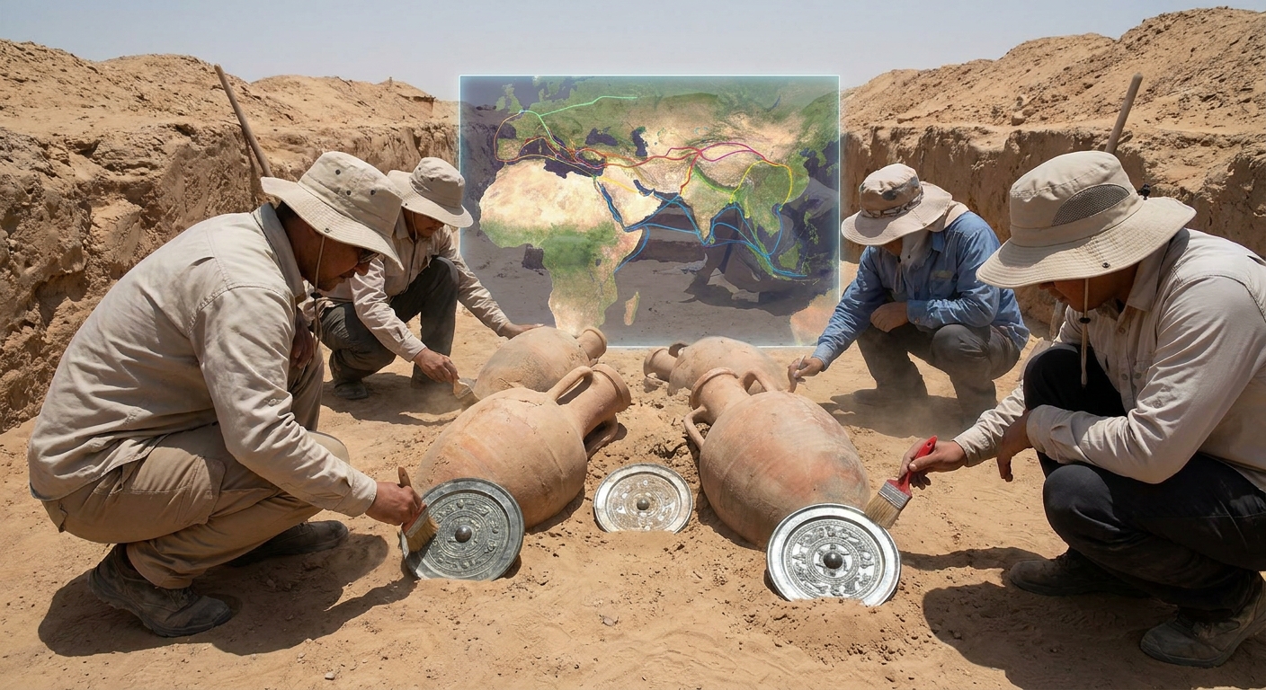
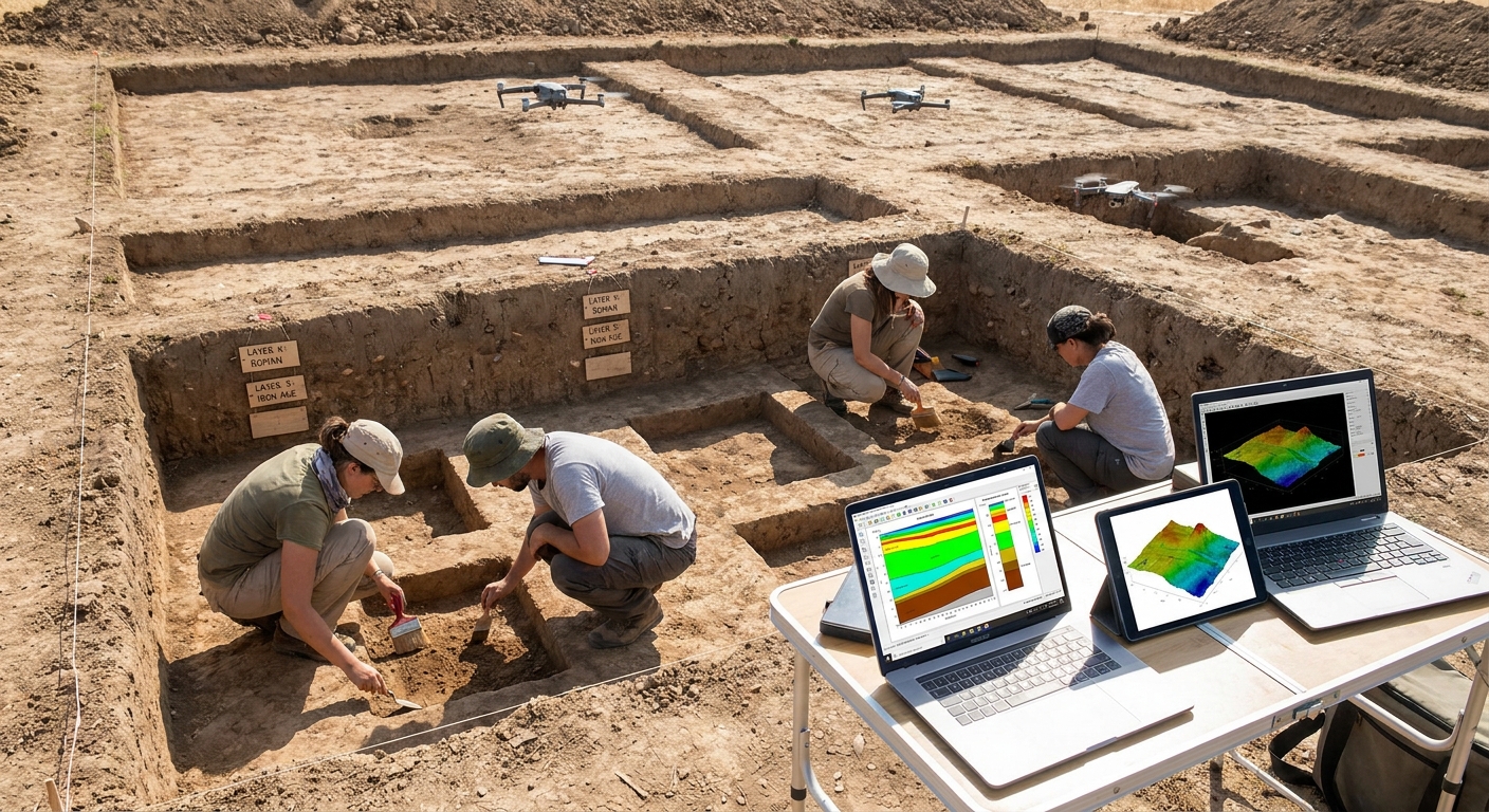
6. Remote Sensing and Lidar: Seeing Invisible Landscapes
Remote sensing covers aerial photography, satellite imagery, geophysical survey, and lidar (light detection and ranging). These tools allow archaeologists to detect buried features without digging.
Lidar in the Rainforest
In the last decade, lidar has transformed our understanding of lowland Maya cities. Airborne lasers penetrate forest canopy and measure ground elevation with centimeter precision.
At Caracol (Belize) and around Tikal (Guatemala), lidar has revealed:
- Extensive terraced agriculture.
- Causeways linking outlying settlements.
- Dense, continuous urban sprawl where once only isolated temple complexes were visible.[^5]
The resulting digital terrain models let researchers model water management, population estimates, and movement corridors long before a trench is opened.
7. Digital Archaeology: From 3D Models to Big Data
Digital tools do more than make pretty reconstructions. They allow archaeologists to test hypotheses and share datasets.
3D Reconstruction and Light Simulation
Rebuilding structures in 3D makes it possible to simulate how light entered a Neolithic chambered tomb at different times of year, or how sound carried in a Roman theater. These simulations can be compared to alignments recorded in primary sources—for instance, the description of sunrise in Plutarch’s account of the Temple of Isis at Philae.
Databases and Open Science
Large regional projects—like the "Comparative Archaeology Database" at the Penn Museum or the "Pleiades" gazetteer—aggregate site data, inscriptions, and artifact records.
By querying thousands of entries at once, researchers can trace macro-patterns:
- The spread of particular ceramic styles.
- Shifts in burial customs across centuries.
- Correlations between climate proxies and settlement density.
This “big data” perspective complements the micro-scale detail of the excavation trench.
Why Methods Matter to the Modern World
These techniques do more than fill museum cases; they give us empirical, testable narratives about long-term change.
- Climate and resilience: Pollen cores and settlement patterns help model how societies adapted—or failed to adapt—to droughts and floods, informing modern resilience planning.
- Inequality and health: Bioarchaeological studies of nutrition and workload clarify the ancient roots of social disparities.
- Migration and identity: Isotope and DNA evidence show that migration and mixture are ancient norms, challenging simplistic modern notions of "pure" cultures.
As new tools emerge—from ancient DNA sequencing to machine learning pattern recognition—the core archaeological challenge remains: how to move from trace to explanation without overstepping the evidence. The best work pairs high-tech methods with old-fashioned rigor, always asking what a given technique can and cannot legitimately tell us.
The next time you see an artifact in a display case, remember: it is only the visible endpoint of a long chain of methods, measurements, and judgment calls that began in the dirt.
[^1]: Whittle, A. (2011). Europe in the Neolithic: The Creation of New Worlds. Cambridge University Press.
[^2]: Palaima, T. (2004). Sacrificial Feasting in the Linear B Tablets. Hesperia.
[^3]: Nissen, H. J. (1993). The Early History of the Ancient Near East, 9000–2000 B.C. University of Chicago Press.
[^4]: Prowse, T. et al. (2007). Isotopic Evidence for Mobility and Subsistence in Imperial Rome. American Journal of Physical Anthropology.
[^5]: Chase, A. F. et al. (2011). Airborne Lidar, Archaeology, and the Ancient Maya Landscape at Caracol, Belize. Journal of Archaeological Science.