Some lost empires vanish beneath sand; others dissolve under jungle. The ancient Maya kingdoms of Mesoamerica—never a single unified empire, but a constellation of rival city-states—were long swallowed by ceiba trees, strangler figs, and the quiet industry of leafcutter ants.
Introduction: Following Stone Roads Through the Canopy
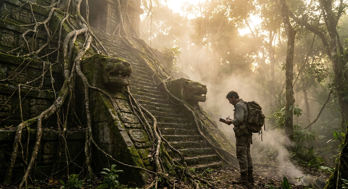
For 19th‑century explorers like John Lloyd Stephens and Frederick Catherwood, stumbling onto the vine‑covered plazas of Copán or Palenque felt like entering a dream. Today, archaeologists armed with lidar and GPS have replaced machetes and sketchbooks—but the sense of discovery remains.
This field guide is not about tourist logistics. It is a narrative and scholarly map of how to read Maya sites: how to move from seeing “ruins in the jungle” to understanding complex political capitals whose histories we can trace in stone glyphs and household trash.
Step 1: Learn to See a Maya City-State, Not a Monolith
Popular culture speaks of “the Maya Empire,” but inscriptions and archaeological patterns show something more intricate: dozens of independent polities anchored by cities like Tikal, Calakmul, Palenque, Copán, and Yaxchilán.
Primary sources—the carved stelae and lintels still standing in plazas—name rulers as k’uhul ajaw (“holy lords”) of specific places. A typical emblem glyph might read: “Holy Lord of Mutal”—Mutal being the ancient name for Tikal.
When you arrive at a Maya site—whether in person or via a satellite image—look for:
- The Central Acropolis: Palaces and residential compounds of the elite, a dense cluster of multi-room structures.
- Ceremonial Plazas: Open spaces framed by temples and pyramids; venues for rituals, performances, and royal propaganda.
- Stelae and Altars: Upright stones with hieroglyphic inscriptions and carved kings, often arranged in plazas like stone annals.
Each of these architectural elements served a city-state’s political economy: broadcasting the power of a dynasty, anchoring sacred geographies, and mediating between commoners and gods.
Step 2: Listen to the Stone Voices – Deciphered Hieroglyphs
Until the late 20th century, scholars treated Maya inscriptions more as symbolic art than as written history. That changed through the work of figures like Tatiana Proskouriakoff, Yuri Knorozov, Linda Schele, and others who demonstrated that Maya glyphs recorded phonetic syllables and logograms.
Today we can read names, dates, and events with startling precision.
At Tikal, for example, Stela 31 (c. 445 CE) records the accession of Siyaj Chan K’awiil II and references his father, Yax Nuun Ahiin I, a ruler installed after the arrival of the foreign warlord Siyaj K’ak’ (“Fire Is Born”) in 378 CE. This aligns with archaeological evidence for a Teotihuacan-linked military intrusion, visible in new styles of pottery and architecture.
Key concepts to watch for on glyphs:
- Long Count dates: Numbers that allow us to anchor events to specific days between the 1st millennium BCE and 10th century CE.
- Emblem glyphs: Titles linking a ruler to a city-state.
- War events: Verbs like ch’ak (axe/decapitate) and puluuy (burn) associated with attacks.
Understanding that these are historical narratives—not just mythic tableaux—transforms a carved panel from decorative relief into political reportage.
Step 3: Trace Power Through Ballcourts, Causeways, and Waterworks
Archaeology reveals the infrastructure of authority: how rulers mobilized labour and managed resources.
Ballcourts: Ritual and Politics
The Mesoamerican ballgame, played in I‑shaped courts, was both athletic contest and ritual performance. At sites like Copán, inscriptions on ballcourt markers link games to dynastic ceremonies.
For instance, on Marker 3 of Copán’s Ballcourt A‑II, a hieroglyphic text associates the monument with the ruler 18‑Rabbit (Waxaklahun Ubah K’awiil) and a specific calendar date. This intertwines royal self-presentation with the game’s cosmological symbolism.
Causeways (Sacbeob): Stone Roads of Authority
Raised white roads, or sacbeob, connected temple complexes and outlying settlements. Lidar surveys over the last decade have revealed sprawling networks that suggest much tighter integration between central sites and rural peripheries than visible at ground level.
At Uxmal and in the Puuc region, sacbeob linked multiple centers, implying regional polities whose boundaries we can now sketch more confidently.
Water Management: Survival as Statecraft
In the seasonal tropics of the Maya Lowlands, water control was existential. Excavations at Tikal show massive aguadas (reservoirs), some lined with plaster and featuring sluice systems.
Geoarchaeologist Lisa Lucero’s work at Caracol and other sites identifies complex hydraulic landscapes—terracing, check dams, and reservoirs—that tied ecological stability to political legitimacy. Droughts in the 9th century CE, evidenced by lake sediment cores and speleothems, would have stressed these systems, contributing to the so‑called Classic Maya “collapse.”
Step 4: Step Inside a House: Ordinary Lives in Lost Kingdoms
Great temples dominate photographs, but the vast majority of Maya people experienced life in household compounds built of perishable materials atop low platforms.
Excavations at Ceren (in El Salvador), a village buried by a volcanic eruption around 600 CE and often likened to a “Maya Pompeii,” preserve:
- Grinding stones (metates) set with manos mid-use.
- Stored maize in ceramic containers.
- Household altars and figurines.
These finds show how cosmology suffused daily tasks. Offerings to household gods, ancestor veneration under house floors, and the orientation of buildings to celestial events all tie domestic routines to broader worldviews.
Stable isotope analysis of human remains from sites like Copán reveals diet patterns: heavy reliance on maize (Zea mays), supplemented by beans, squash, and occasional meat. Dental wear and enamel hypoplasia patterns tell stories of weaning practices and food stress.
Step 5: Follow the Collapse and Continuity
The trope of the “mysterious disappearance of the Maya” persists, but inscriptions and material culture tell a more nuanced story.
Between roughly 750 and 900 CE, many southern lowland cities—Tikal, Copán, Palenque—experienced population decline, halted monumental construction, and political fragmentation. Primary evidence includes:
- Abrupt ends to hieroglyphic inscriptions; last-known dates at some sites cluster in the late 8th to early 9th centuries.
- Abandoned palaces and uncompleted stelae.
- Paleoclimate data (e.g., from Lake Chichancanab) indicating multi-decadal droughts.
Yet the Maya did not vanish. Northern centers like Chichén Itzá and later Mayapán flourished. Colonial-era ethnographic accounts, such as Bishop Diego de Landa’s 16th‑century Relación de las cosas de Yucatán (problematic but invaluable), show enduring Maya languages, rituals, and social structures.
Modern Maya communities across Mexico, Guatemala, Belize, Honduras, and El Salvador still speak descendants of Classic languages—Yucatec, K’iche’, Kaqchikel, and many more.
Step 6: Connect Ancient Maya Worlds to the Present
Studying the lost Maya empires is not antiquarian escapism; it illuminates issues at the heart of our own century.
Climate Resilience and Vulnerability
The Classic Maya faced prolonged droughts layered atop population growth and political rivalry. Their responses—intensified water management, agricultural diversification in some areas, warfare and factionalism in others—offer case studies in societal resilience and fragility.
Urban Design and Green Cities
Lidar has revealed that Maya cities were low-density, agriculturally embedded urban forms rather than compact stone metropolises. Fields, orchards, and forest gardens interlaced with residential zones, challenging our notions of what a city must be.
Contemporary planners looking at sustainable urbanism can draw inspiration from these agro-urban mosaics, where food production and habitation intermingled.
Heritage, Identity, and Rights
Maya archaeology is deeply entangled with contemporary politics. Questions of land rights, control of sacred sites, and representation in research agendas foreground debates about who “owns” the past.
Collaborative projects increasingly involve community archaeology, bilingual interpretive materials, and local decision-making. Ancient polities may be lost, but their descendants rightfully claim a voice in telling that history.
Further Reading and Primary Sources
For those wishing to dig deeper:
- Schele, Linda, and David Freidel. A Forest of Kings: The Untold Story of the Ancient Maya. William Morrow, 1990.
- Martin, Simon, and Nikolai Grube. Chronicle of the Maya Kings and Queens. Thames & Hudson, 2000.
- Lucero, Lisa J. Water and Ritual: The Rise and Fall of Classic Maya Rulers. University of Texas Press, 2006.
- Coe, Michael D., and Stephen Houston. The Maya. 9th ed. Thames & Hudson, 2015.
In the end, to explore the lost Maya empires is to practice a kind of double vision: to hold in mind the quiet forested mounds of today and the crowded plazas of a thousand years ago, where incense hung in the air and kings carved their deeds into stone, confident that they would never be forgotten.