Stand on a country lane in rural Europe, and you may be closer to the Middle Ages than you think. Field patterns, church placements, even the names on signposts can echo a landscape shaped a thousand years ago.
Why Learn to "Read" a Medieval Village?
This practical guide explains how to interpret the traces of a medieval village—real or reconstructed—using techniques historians and archaeologists rely on. Whether you’re walking through an English hamlet, a French village-rue, or a deserted settlement on a hillside, you can learn to see the past in the present.
We’ll use examples from well-studied sites like Wharram Percy (England), Montaillou (France), and desolated villages in Central Europe, drawing on manorial records, inquisitorial registers, and archaeological digs.
1. Start with the Name: What Place-Names Reveal
Before looking, read. Place-names often preserve medieval clues about environment, ownership, and function.
Common Elements (with English Examples)
- -ton / -tun (farmstead, enclosure): "Norton," "Appleton" suggest early enclosed farms.
- -ham (homestead): "Rotherham," "Fulham" often indicate early settlements.
- -by (Old Norse for farm): "Derby," "Grimsby" mark Viking influence in northern/eastern England.
- -ville / -villar (in French): Indicates a farm or estate, often tied to medieval colonization.
Local charters and surveys, like the Domesday Book (1086) in England, list early forms of these names. Comparing the medieval spellings to the modern ones can reveal shifts in language and land use.
In Occitan-speaking southern France, names incorporating "mas" often signal individual farmsteads, crucial in cases like Montaillou, whose 14th-century Inquisition records preserve detailed testimony about villagers and their houses.
How to use this today: When you enter a village, check a detailed map or guide for name origins. They often hint at when and why a settlement arose—Roman road stop, forest clearing, riverside market.
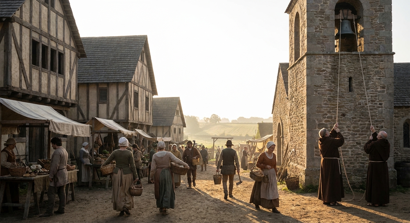
2. Find the Church: Spiritual and Social Center
In many European villages, the parish church is the oldest surviving building. Its location was strategic.
Locational Clues
- Often on a slight rise or central knoll—visible and dry.
- Frequently near a spring or well (sometimes now vanished).
- Surrounded by a graveyard whose boundaries might be ancient.
Archaeological excavations around churches (as at Wharram Percy) often uncover earlier wooden churches or pre-Christian burial grounds, showing continuity of sacred space.
Reading the Building
Even without architectural expertise, you can note:
- Stone type and size: Rough, small stones can signal early phases; more regular ashlar masonry often indicates later rebuilding.
- Windows: Tiny, round-arched windows belong to Romanesque phases (11th–12th c.); taller, pointed ones to Gothic (13th–15th c.).
- Wall lines: Bulges or changes in masonry may mark extensions.
Parish records rarely survive back into the early Middle Ages, but later registers, wills, and churchwardens’ accounts show how the church functioned as:
- A liturgical hub (baptisms, marriages, funerals).
- A meeting place for village decisions.
- A storehouse of collective memory (tombs, memorial plaques).
On site tip: Walk the perimeter of the churchyard. The shape—circular, oval, or irregular—can indicate long-term use. In some regions, a circular churchyard hints at very early, perhaps pre-Christian, boundaries.
3. Read the Fields: Lines in the Land
Look beyond the houses to the surrounding fields. Medieval cultivation left physical signatures still visible from the ground or air.
Open-Field Systems (Common in England and Parts of France, Germany)
Features to look for:
- Ridge and furrow: Waves in pasture land, parallel ridges with shallow troughs. These formed from repeated plowing with non-reversible plows, turning soil in one direction.
- Long strips: Fields that are long and narrow, sometimes curved, reflect strips assigned to peasant households.
Manorial court rolls and surveys list who held which strips, measured in acres or "selions." Combined with aerial photography and fieldwalking, historians can reconstruct which family worked which patch of ground.
Terraces and Lynchets (Common in Hilly Areas)
In upland or sloping regions, medieval farmers carved terraces to create flatter fields. These can appear as:
- Step-like platforms on hillsides.
- Low banks or scarps following contour lines.
Archaeological soil analysis frequently finds medieval pottery in these terrace soils, dating periods of intensive cultivation.
How to spot: Look across slopes at oblique angles in low light (morning or evening) when shadows make subtle earthworks stand out. Even if land is now wooded or reverted to pasture, the lines may remain.
4. Trace the Streets and Plots: The Village Plan
Once you’ve taken in church and fields, focus on how houses and streets are arranged.
Common Layout Types
- *Street Village (village-rue): One or two main streets with houses lining them, often with long narrow plots stretching back. Common in parts of France and Germany.
- Green Village: Houses arranged around a central green or common, used for grazing and gatherings.
- Clustered or Nucleated Village:* Houses tightly grouped without clear linear arrangement, often on a knoll or crossroads.
Late medieval maps are rare, but land surveys, tithe maps (early modern), and field archaeology help reconstruct earlier layouts. Wharram Percy, for instance, revealed a two-row street village with house platforms and plot boundaries.
House Platforms and Boundaries
In deserted or partly deserted villages, you may see:
- Rectangular raised areas where timber-framed houses once stood.
- Hollow ways: sunken trackways formed by long use.
- Low banks or ditches marking property edges.
Ceramic sherds, animal bones, and metal finds from these areas confirm domestic occupation.
On site tip: Follow a main street from church outward. Note changes in house density and plot size; they can signal expansions or shrinkage over centuries.
5. Look for Water and Mills: Economic Engines
Water was central to medieval village life—for drinking, animals, irrigation, and power.
Springs, Wells, and Ponds
Village wells, often near the church or green, might now be capped or replaced by pumps. Ponds may sit in slight depressions, sometimes with embankments.
Documentary sources occasionally mention rights to draw water or disputes over wells in manorial courts. These hint at shared and contested resources.
Mills
Watermills were valuable assets, often lord-owned. Cartularies and estate records note their existence and income.
On the ground, look for:
- Mill streams or leats—artificial channels diverting water.
- Embankments and millponds.
- Masonry foundations near streams, sometimes reused as barns or houses.
Excavations at mill sites commonly reveal millstones, metal fittings, and water management structures. Some villages had windmills instead; look for mound-like bases on higher ground.
Why it matters: Mills concentrated economic power; peasants were often obligated to use the lord’s mill (and pay to do so). That obligation appears in manorial records and shaped daily routines.
6. Cemeteries and Bones: Traces of Lives and Deaths
Churchyards and burial grounds are key archaeological and historical resources.
At Wharram Percy, large-scale excavation of the cemetery revealed:
- Demographic patterns (high infant mortality, periodic crises).
- Signs of disease, malnutrition, and physical labor (arthritic joints, stress markers).
- Changing burial customs (orientation, grave goods—mostly absent by the High Middle Ages).
Written sources rarely talk about ordinary villagers’ health in detail. Skeletal evidence fills this gap.
When visiting:
- Note gravestone dates (later, from early modern periods onward) to see patterns of occupation and abandonment.
- Observe orientation of graves (usually east–west in Christian contexts).
Behind every stone or unmarked grave is a life woven into the field systems and house plots you’ve just read.
7. Listen for Voices: Documents that Animate the Landscape
Physical traces come alive when paired with texts. A few key source types:
Manorial Court Rolls
Recorded lords’ courts handling:
- Land transfers between peasants.
- Fines for breaking village by-laws (grazing animals illegally, neglecting hedges).
These rolls, surviving for villages across England and parts of France and Germany, list names, relations, and micro-dramas. They let historians connect specific house plots or fields to individuals.
Tax Lists and Surveys
Poll taxes, hearth taxes, and lay subsidies in later medieval periods list householders and sometimes occupations. Early surveys (like the English Domesday Book) outline who held what in the 11th century.
Inquisitorial and Ecclesiastical Records
Montaillou’s 14th-century Inquisition dossier records villagers’ testimony verbatim (as far as we can tell), revealing internal life: who visited whose house, what they believed, whom they loved.
Reading these alongside the landscape, we can imagine:
- A path villagers took between house and field.
- Conversations whispered on thresholds.
- Conflicts over boundaries or resources.
Practical step: Before or after visiting a village, search for its name plus "cartulary," "court rolls," or "inquisition" in online archives or scholarly databases. Even brief excerpts give color to the stones and soil.
8. Connecting Medieval Villages to Our World
Many villages today still follow medieval outlines, even if buildings have changed. Others, deserted by plague, enclosure, war, or economic shifts, lie as grass-covered earthworks.
Understanding how to read them matters because:
- It shows how deeply history is embedded in everyday landscapes.
- It highlights long-term relationships between people and environment—useful in debates about sustainability and rural policy.
- It recovers the lives of people rarely named in grand chronicles: smallholders, cottars, widows, shepherds.
Primary sources and archaeology together let us reconstruct not just where they lived but how they organized community, coped with scarcity, and negotiated power.
The next time you stroll through a village—real or reconstructed in a museum—try this method: read the name, find the church, scan the fields, trace the streets, follow the water, respect the graves, and, where possible, consult the records.
You won’t just see houses and hedges. You’ll see a medieval world layered beneath your feet.